Aerial drone.
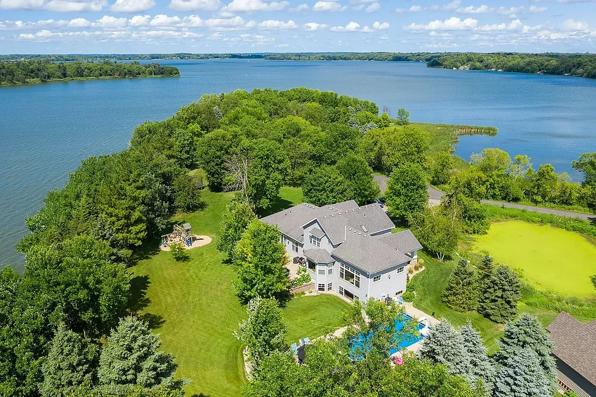
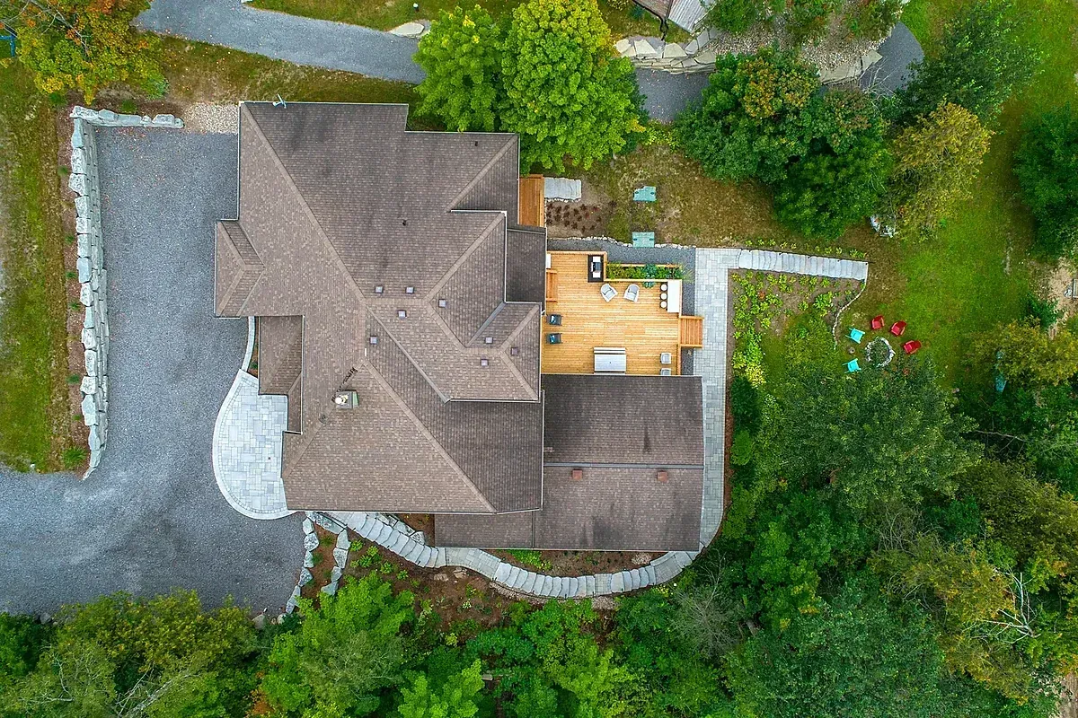
Licensed drone photography and 4K video. Lot size, views, and neighbourhood context from above. Delivered in 48 hours. Vancouver airspace clearance handled.



What's in every drone shoot.
How it works.
Three steps from booking to a listing ready to go live.
Book online
Pick your package and date, then send the address. No deposit, and you get a confirmation with a prep checklist.
We shoot on schedule
I arrive on time and shoot every room to the same standard, with natural light, true colour, and straight verticals.
Photos the next morning
Your gallery lands the next morning, sorted for MLS, Realtor.ca, Airbnb, and social.
Simple, fixed pricing.
Every package price, add-on price, and what each one includes is on one page. No quote form needed to see a number.
Customer reviews
Agents and hosts who book again.
Send the address the night before and the photos land the next day. One booking, one invoice, listing live the same day.
Book a shootWrite a review
Worked with Coastal Photo? Tell other agents and hosts what the shoot was like.
Thanks for your review.
It will be added to the site shortly.
Who books aerial drone.
Luxury listings
$2M+ listings without aerial photography look incomplete. Buyers at this level expect it and compare listings against those that have it.
Acreage & Estate Listings
A 1-acre lot photographed from the ground looks the same as a 0.1-acre lot. Drone shows the truth. That truth sells.
View Properties
Ocean views, mountain panoramas, city skylines. You can't capture these from the ground. Aerial puts buyers in the right frame of mind to pay for the view.
Add to your booking.

Real Estate Photos
MLS-ready interior and exterior photos, delivered next day.
Learn more →
Airbnb Photos
Bright photos for Airbnb, VRBO, and short-term rentals.
Learn more →
Video & Reels
Listing walkthrough video and short-form social reels.
Learn more →
2D Floor Plan
Measured floor plan, MLS-ready and print-formatted.
Learn more →
Commercial Photography
Interior and exterior photography for offices, clinics, and storefronts.
Learn more →Serving Greater Vancouver & the Lower Mainland.
From Yaletown condos to North Shore estates, wherever your listing is, we're there.
Yaletown
Condo & loft photography for downtown Vancouver listings.
Yaletown real estate photography →Kitsilano
Character homes and coastal properties along West 4th.
Kitsilano real estate photography →West Vancouver
Luxury estate photography for Dundarave and Ambleside listings.
West Vancouver real estate photography →North Vancouver
Detached home and strata photography across the North Shore.
North Vancouver real estate photography →Burnaby
MLS photography for Metrotown, Brentwood, and Burnaby Heights.
Burnaby real estate photography →Richmond
MLS-ready photography for Richmond condos and detached homes.
Richmond real estate photography →Coquitlam
Real estate photographer serving Port Moody and Tri-Cities listings.
Coquitlam real estate photography →Surrey
Property photography for Surrey, Langley, and the Fraser Valley.
Surrey real estate photography →Coal Harbour
High-end harbour-view condo photography for luxury MLS listings.
Coal Harbour real estate photography →Gastown & Mount Pleasant
Loft and heritage character home photography in East Vancouver.
Gastown & Mount Pleasant photography →Frequently asked questions
Photos are delivered within 24 hours via a private online gallery. Files are split by platform: MLS-sized, web-sized, and square crops for Instagram. Same-day rush is available for +$49 (confirm before 11am for 9pm delivery).
Metro Vancouver and the Lower Mainland are covered at no extra charge. North Shore is included. Squamish: +$100. Whistler: +$200. Tsawwassen: +$50. Further areas by request. See full travel fee list →
The shoot moves to the next dry slot at no charge. Vancouver weather is part of the job. If a tight deadline is at risk, I'll bring in a vetted second shooter at no extra cost.
Open all blinds, turn on all interior lights including lamps, and remove vehicles from the driveway. You'll receive a detailed prep checklist when you book.
I retain copyright, but you receive a full commercial licence to use the images for MLS, your personal brand, and your portfolio indefinitely. Galleries stay live for 12 months. Re-delivery any time, no charge.
Add aerial context to your listing.
Share the address, timeline, and view priorities. We'll confirm airspace, weather, and the right drone package.